Historical Sketch
This writing is an abridged selection from a publication entitled, The Inventory of the Parish Archives of Louisiana, Volume No. 6. Beauregard Parish (DeRidder); Prepared by The Historical Records Survey Divisions of Professional and Service Projects Work Project Administration, published by The Department of Archives Louisiana State University, October 1940.
Beauregard Parish is located in what was the northwest corner of Opelousas County, created in 1806 as a division of the Territory of Orleans. (1) The boundaries of Opelousas embraced the entire southwestern section of the state and in the northeast extended almost to the Mississippi River. (2) With the inception of the parish form of government in 1807, the area of Opelousas was called St. Landry Parish. The boundaries of St. Landry were not altered until 1840, when the western portion was designated as Calcasieu Parish. (3)
The recorded history of the region begins in the latter part of the eighteenth century, when the land between the Rio Hondo and the Sabine, called the Neutral Strip, was under Spanish jurisdiction. After the first land grant in 1797 the territory was a notorious refuge for desperadoes for many years before permanent settlers inhabited it. (4) Settlement by pioneers was not made as early in the region of Calcasieu, from which Beauregard was created, as in some other portions of southwestern Louisiana. Pioneer settlers entered the region about 1815 and formed settlements along the Calcasieu River, then known as the Rio Hondo. These settlements spread with the westward advance and resulted in the organization of new parishes from the old Opelousas area. (5)
Prior to the coming of pioneer settlers, the area was inhabited by a few tribes of the Atakapa group. This tribe consisted of a great number of small bands roving along the gulf coastal region from Vermilion Bay to Galveston Bay, and along the rivers Mermentau, Rio Hondo (or Calcasieu), and the lower Sabine and Neches.
When Texas loomed as a great country and severed her connection with Mexico, the region remained the outskirts between Louisiana and Texas. The land lying between the Rio Hondo and the Sabine was a disputed territory claimed by the two states. (6) A few adventurous pioneers came into the section east of the Rio Hondo under Spanish grants from the Louisiana state authorities. A few others, perhaps two hundred and fifty, settled in the western region under what were termed the Rio Hondo claims. Among the Indians in the western region, afterwards ceded to the United States as part of Louisiana, sprang a race of people of mixed ancestry. These and a few others for many years constituted the entire population of the region. (7)
According to tradition, the first pioneer settler in the area now comprising Beauregard Parish was “Saddler” Johnson, who acquired his sobriquet through his work as a saddle maker. He settled in the Sugartown community, the first permanent settlement in the parish, around 1825. Prominent among the early settlers were Edwards Eacoubas, Dempsey Iles, John L. Lyons, Joseph W. Moore, E. Sherley, James Simmons, William B. Welborn, Ezra Young and G. W. Corkran. The second community was that of Dry Creek, founded by Thomas W. Williams. Another settlement was founded at Petersburg, six miles south of present Leesville, in the late 1830’s or early 1840’s. It was named after Pete Eddleman, one of the settlers. Most of the group composing this settlement came from South Caroline and Florida.(8)
The Calcasieu area received quite an influx of population from Hancock County, Mississippi between 1848 and 1851 and a number of them settled in present Beauregard. During the next decade the area was settled rapidly, and it has been estimated that the area which is now Beauregard Parish contained a population of 4,000. During the Civil War, a portion of this group migrated to the north. The Louisiana act of secession was opposed by most of the parish residents by the majority supported the Confederacy. (9)
During the War, when it became necessary to furnish General Taylor’s retreating army with provisions and ammunition, a military road was hastily cut from Niblett’s Bluff to Alexandria. A portion of the road was cut by residents of present Beauregard and for many years the military road was the only road in the parish. “It entered the parish near the southwest corner and ran diagonally through the parish, entering what is now known as Allen Parish less than a mile from the northeast corner of the Beauregard line.”(10)
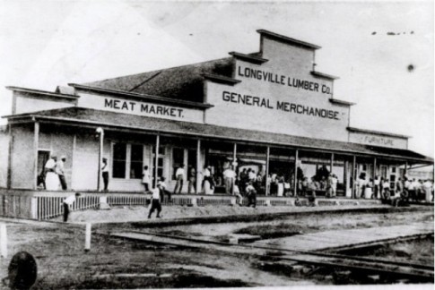
The movement to create Beauregard Parish was begun in 1908 by a group of business men from the towns of DeRidder, Sugartown and Merryville. Through their efforts a bill was introduced into the state legislature for the creation of a parish but it was voted down. A second and successful attempt was made in 1912 when interested citizens from the parish met at DeRidder and selected a group of men to go to Baton Rouge to lobby for the creation of the parish. (11)
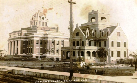
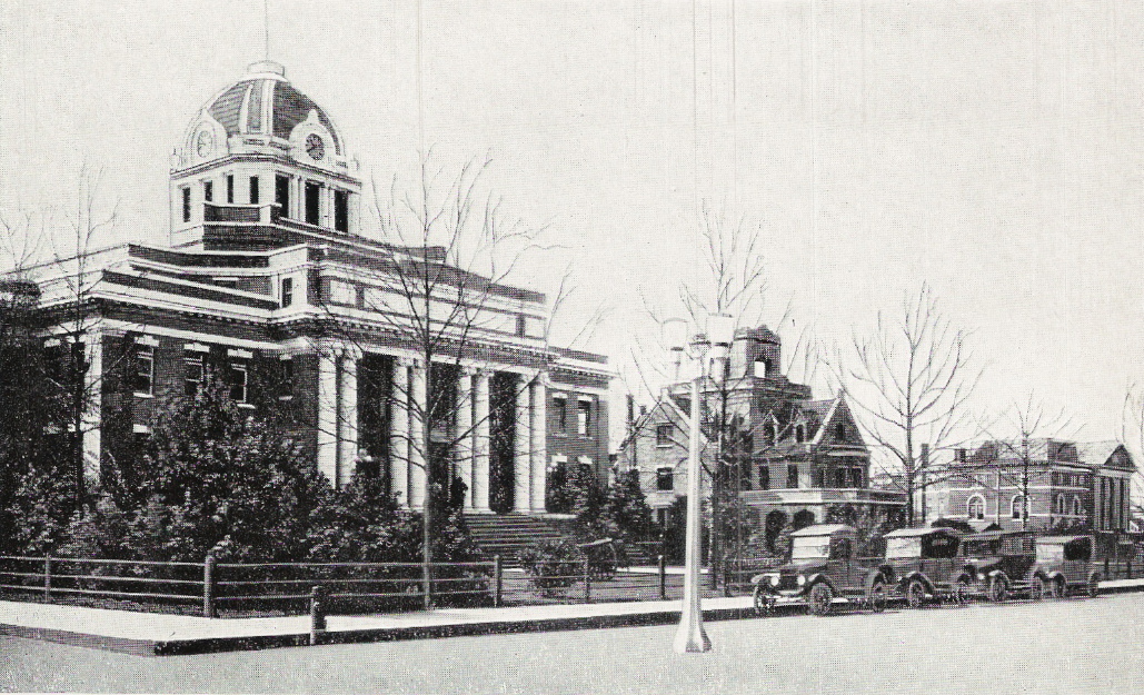
Beauregard Parish was created June 12, 1912 from the Parish of Calcasieu. (12) The Parishes of Allen and Jefferson Davis were created on the same day and the three were the last parishes created of the present sixty-four. Beauregard is located in the extreme western section of the state. It is bounded by Vernon, Allen and Calcasieu parishes on the North, East and South respectively, and by Texas on the West.(13) The Parish has a land area of 1,172 square miles. It was named in honor of General Pierre Toutant Gustav Beauregard, 1818-1893, outstanding military leader in the Mexican and Civil Wars.
|
The Clerk is very interested in publishing more historical accounts and photographs on this website. If you have information or photos that you would like to submit please forward them to us at the following address
|
1. Or. Terr. A., 1804-05, ch. XXV, sec. 1.
2 . Historical Records Survey, Country-Parish Boundaries in Louisiana, New Orleans, 1939, p. 18. Hereafter cited as County-Parish Boundaries.
3. Ibid., p. 53; Or. Terr. A., 1807, ch. I, sec. 9; La. A., 1840, E.S., #72, sec. 1.
4. Thomas Maitland Marshall, A History of the Western Boundary of the Louisiana, Purchase, 1819-1841, Berkeley, Calif., 1914, pp. 18, 47. Hereafter cited as Marshall, Western Boundary; Rex Laney (ed.), Do You Know Louisiana, Baton Rouge, 1938, p. 98. hereafter cited as Laney, Do You Know Louisiana.
5. William Henry Perrin, Southwest Louisiana, Biographical and Historical, new Orleans, 1891, pp. 123, 129. hereafter cited as Perrin, Southwest Louisiana.
6. Marshall, Western Boundary, passim.
7. Perrin, Southwest Louisiana, p. 123.
8. Mrs. Lether Edward Frazer, "Early Annals of Beauregard Parish," Unpublished Master's Thesis, Louisiana State University, 1933, pp. 18-20.
9. Ibid., pp. 21-22, 24.
10. Ibid., pp. 24-25.
11. Ibid., p.28.
12. La. A., 1912, #8, sec. 3.
13. Idem; John D. Klorer (ed.), The New Louisiana, New Orleans, 1936, p. 47.